UAV Mapping
UAV Mapping
Quick deployment, detailed capture, and fast data processing for smaller areas.
An unmanned aerial vehicle system can quickly and inexpensively collect highly detailed data over smaller project areas. Once data collection is complete, fast and automatic processing supports speedy delivery of useful mapping products.
UAV workflows provide quick deployment and turn-around times with accurate reporting from point cloud datasets. Survey ground control, processing, and reporting are carried out by experienced survey teams.
Rapid UAV production
Ground control, aerial capture, point cloud processing, surface models, contours, and hosted imagery.
Mapping Support
Prepared to support UAV mapping projects with modern aerial technology.
Prepared to support UAV mapping projects with modern aerial technology, delivering accurate geospatial data for surveying, planning, and analysis. Our solutions combine advanced drone systems, high-resolution imaging, and efficient data processing to ensure reliable results for infrastructure, agriculture, construction, and environmental projects.
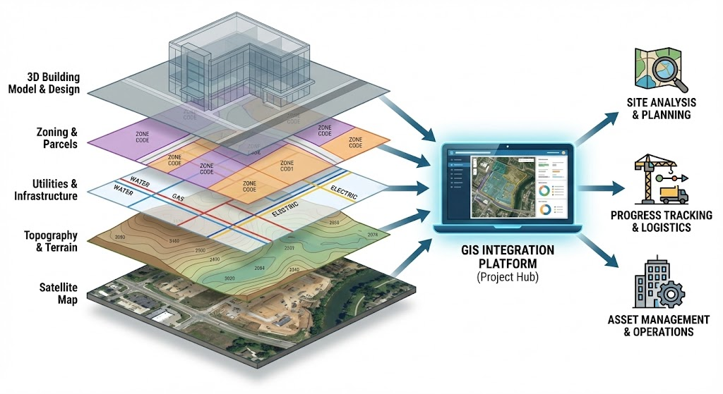
Orthophoto Mosaics
High-resolution orthophoto mosaics, including products with less than 1 inch pixel resolution.
Digital Surface Models
DSM outputs built from UAV imagery and processed point cloud datasets.
TIN Models
Triangulated surface models for terrain interpretation, design support, and analysis.
1ft Contours
Contour products generated from processed UAV surface and elevation information.
Image Caching
Image caching and service hosting support for teams that need accessible mapping layers.
Survey Reporting
Ground control, processing checks, and reporting prepared by experienced survey professionals.
Production Flow