Photogrammetric Terrain Products
Digital Elevation Model / Digital Terrain Model
Accurate relief modelling from survey and photogrammetric elevation data.
A Digital Elevation Model represents surface relief between known elevation points. By interpolating elevation data from ground surveys, aerial imagery, and photogrammetric capture, a rectangular grid can be produced for mapping, engineering, planning, and orthorectification workflows.
DEMs can contain failed, noisy, or misleading values in areas such as water bodies, shadows, dense vegetation, and abrupt terrain changes. We edit and smooth those irregularities so downstream orthophotos, contours, profiles, and analytical products are built on dependable elevation data.
DSM to DTM Conversion
From captured surface elevation to bare-earth terrain.
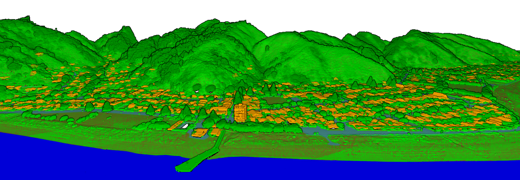
A Digital Surface Model includes above-ground objects such as buildings, trees, and other surface features. A Digital Terrain Model represents the bare-earth surface. For orthorectification and many engineering applications, the DTM usually produces better results because it removes the influence of temporary or elevated objects.
DEMs extracted from overlapping images often begin as DSMs. We convert, edit, and quality check the model before it is used for orthorectified images, contour generation, cut-and-fill analysis, and GIS-ready terrain delivery.
Terrain Representation
Elevation models refined with spot elevations, breaklines, and terrain-aware checks.
Contour Production
Contour plots generated at user-specified intervals for mapping, planning, and design.
Profiles and Sections
Longitudinal and cross-section profiles prepared from reliable elevation surfaces.
3D Visual Outputs
Isometric and perspective terrain views for interpretation, presentation, and review.
Volume Calculations
Cut-and-fill calculations and earthwork quantities derived from elevation models.
Quality Control
Manual inspection and correction of failed pixels, water surfaces, and terrain noise.
Quality-Focused Delivery
High-quality elevation products built for real project decisions.
High-quality elevation products built for real project decisions, providing accurate terrain and surface information for engineering, construction, infrastructure, and land development projects. Our elevation data supports better planning, analysis, and decision-making through reliable models, precise measurements, and detailed geographic insights.
Production Process
Elevation modelling steps before final delivery.
- Interpolate height values at required terrain points.
- Generate contours at project-specific contour intervals.
- Prepare longitudinal and cross-section profiles.
- Create isometric and perspective terrain views.
- Calculate volumes, including cut-and-fill quantities.