Bare Earth Terrain Modelling
Bare Earth / Digital Terrain Model
Clean terrain classification from complex LiDAR point clouds.
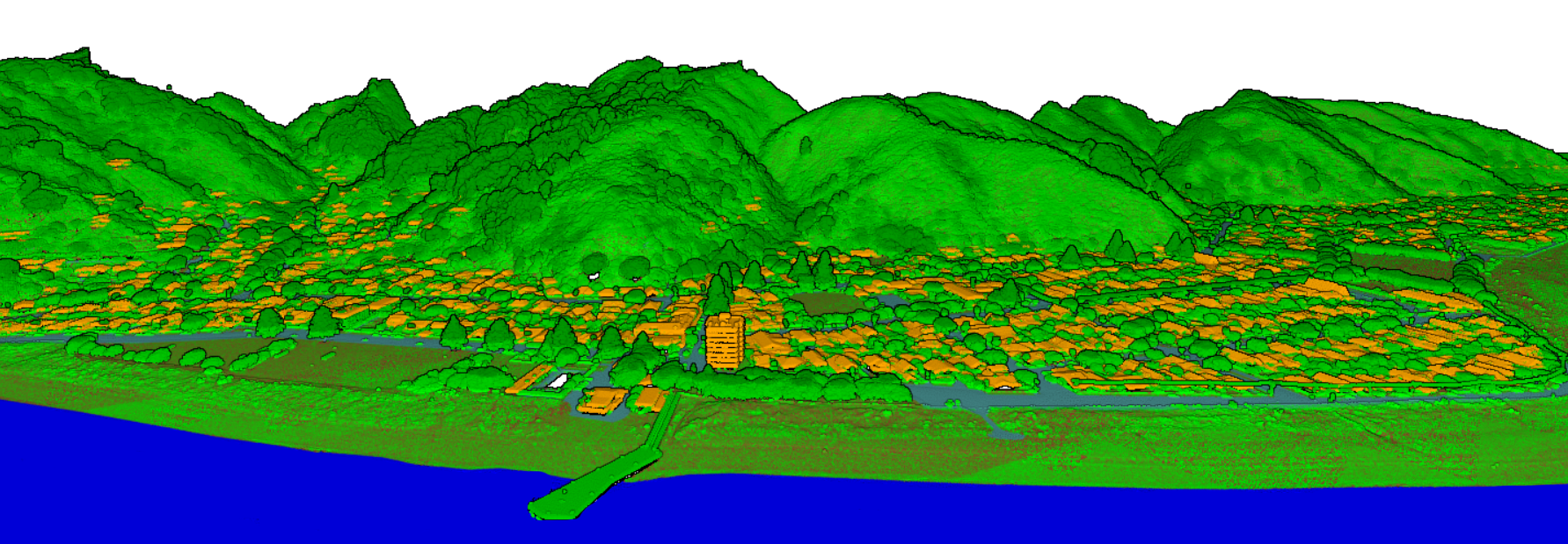
Airborne and mobile LiDAR pulses can return from roofs, vegetation, utility assets, and the earth surface beneath them. DTM classification identifies the reliable ground returns inside that point cloud and converts them into bare-earth terrain products for engineering, GIS, environmental analysis, and infrastructure planning.
Terrain Extraction Workflow
From raw returns to smooth, quality-controlled DTM deliverables.
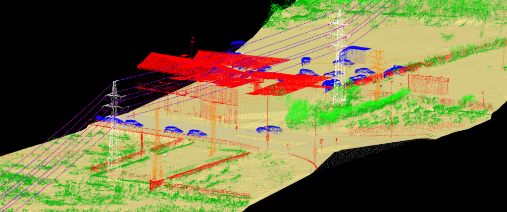
We classify point-cloud returns into ground, vegetation, buildings, powerline objects, water, and other surface classes, then refine the ground layer with manual quality checks. The final output can support contours, breaklines, hydrology modelling, flood studies, corridor design, route planning, and GIS integration.
Bare-Earth Ground Class
Accurate separation of terrain points from buildings, vegetation, vehicles, and other above-ground features.
DTM and Contours
Terrain surfaces, contour-ready outputs, elevation grids, and terrain products for GIS and CAD workflows.
Hydrology Support
Terrain layers prepared for drainage review, flood modelling, watershed analysis, and water-flow studies.
Infrastructure Planning
Reliable ground models for roads, rail, utilities, corridors, land development, and engineering design.
GIS Integration
Structured outputs that combine with orthophotos, vector layers, cadastral data, and planning datasets.
Quality Assurance
Visual inspection, cross-section checks, noise cleanup, and delivery review for dependable elevation data.
3D Modelling and Meshing
Terrain intelligence for visualization, simulation, and project delivery.
DTM classification is the foundation for terrain meshes, 3D visualization, digital twins, simulation-ready environments, and map products that need the true ground surface rather than the top of buildings or canopy. Clean ground data helps teams design with confidence.