LiDAR Corridor Mapping
Utilities Corridor Mapping
Highly accurate 3D corridor models from LiDAR data.
LiDAR data helps generate precise 3D models for corridor mapping, potential-risk analysis, and vegetation encroachment analysis. Our workflow can be adapted to different safety parameters for each voltage, span, pole, tower, or client requirement.
The results give utility teams practical information for network maintenance, planning, prioritization, and compliance checks across electricity, telecommunications, oil and gas, transport, and other corridor assets.
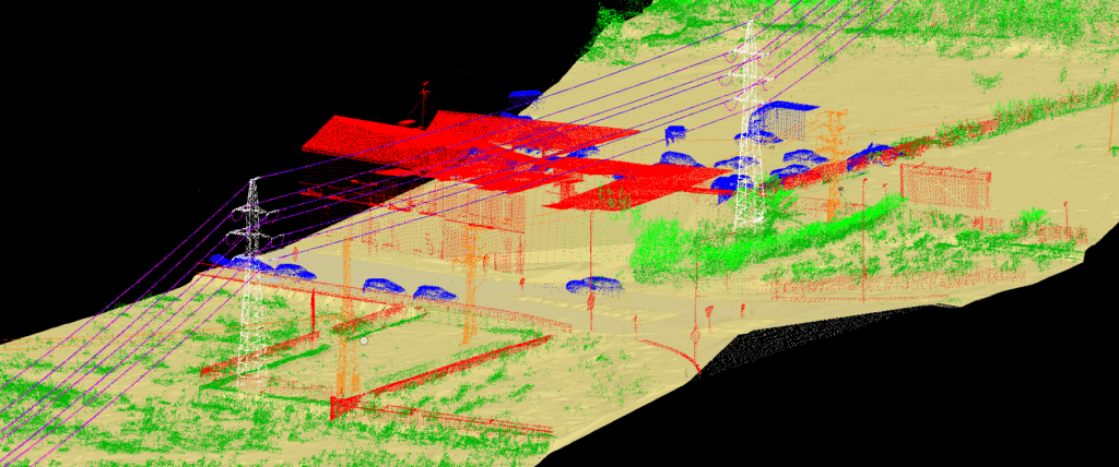
Safety Distance Analysis
Measure clearance from network assets to every feature in the area of interest.
By combining LiDAR data with custom algorithms, we calculate safety distances from poles, wires, towers, and spans to nearby buildings, roads, ground, wires, vegetation, and other corridor elements. These outputs help utilities identify respected clearances, violations, and different levels of infringement for further action.
Utility Corridors
Electricity sagging, telecom, oil and gas, and utility asset analysis for planning and maintenance.
Vegetation Encroachment
Clearance-risk detection around lines, towers, poles, spans, and nearby natural features.
Transportation Mapping
Road, railway, airport, route-planning, pavement, and infrastructure monitoring support.
DTM and DSM Outputs
Elevation profiles, terrain models, surface models, slope checks, and corridor visualization.
Corridor Mapping
Useful for development corridors, hydrological surveys, and infrastructure inventories.
Corridor mapping supports road development, railway development, hydrological surveys, and asset inventories using ALS, MLS, UAV photogrammetry, and LiDAR. Dense point clouds, low-altitude capture, and high-resolution photos make it possible to measure lanes, visualize objects, and analyse transverse and longitudinal surface slopes.
LiDAR combined with imagery is valuable for route planning for road, rail, pipe, and transmission-line infrastructure. It is also effective for maintenance and monitoring of existing assets, including urgency assessment, pavement-damage investigation, and design-build support.